Sea Level at Tierra Verde
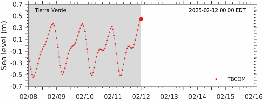
This movie shows the comparison of TBCOM simulated (red) and tide guage observed (blue) water level time series at Tierra Verde. This comparison is also shown as a static plot.
Go back to water level projection home page or view model/data comparison at the other tide gauge stations along the Tampa Bay region:
Disclaimer: The analyses/data are research products under development. No warranty is made, expressed or implied, regarding accuracy, or regarding the suitability for any particular application. All rights reserved: University of South Florida, College of Marine Science - Ocean Circulation Lab. Copyright, 2023.